


Maps of Roman Britain — Main Page
From Wikipedia, the free encyclopedia
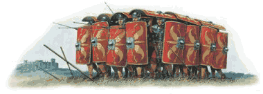
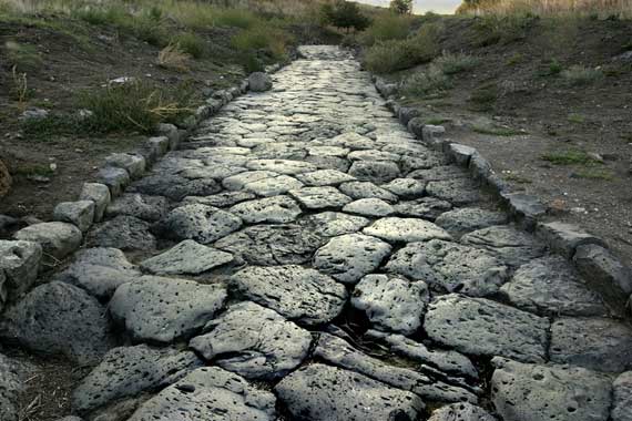
This page is a jumping off point to look at maps of Roman roads around Britain. Roman roads, together with Roman aqueducts and the vast standing Roman army (in the 2nd century, ca. 30 legions plus around 400 auxiliary units, totalling ca. 400,000 troops, of which ca. 50,000 deployed in Britain), constituted the three most impressive features of the Roman Empire. In Britain, as in other provinces, the Romans constructed a comprehensive network of paved trunk roads (i.e. surfaced highways) during their nearly four centuries of occupation (43 — 410 AD).
From Tracks to Roads
The pre-Roman Britons used mostly unpaved trackways for their communications, including very ancient ones running along elevated ridges of hills, such as the South Downs Way, now a public long-distance footpath. By the first century BC, they had begun engineering roads. After the Roman invasion, the road network was expanded. Roman roads were surveyed and built from scratch, with the aim of connecting key points by the most direct possible route. The roads were all paved, to permit even heavy freight-wagons to be used in all seasons and weather.
Most of the known network was complete by 180 AD. Its primary function was to allow the rapid movement of troops and military supplies, but it also provided vital infrastructure for trade and the transport of goods.
Roman roads remained in use as core trunk roads for centuries after the Romans withdrew from Britain in 410 AD. Systematic construction of paved highways did not resume in England until the 18th century.
Key Routes
The old Roman proverb that "all roads lead to Rome" was largely applicable in Roman Britain (Britannia) to London (Londinium), the city founded on a virgin site by the Romans, which soon became the province's capital and largest city. The most important trunk roads were those that linked London with
- the key ports:
- Dover (Dubris)
- Chichester (Noviomagus)
- Portchester (Portus Adurni,)
- the main Roman army bases: the three permanent fortresses housing the legions (castra legionaria)
- York (Eboracum), base of the Ninth Legion: Legio IX Hispana, later the Sixth: Legio VI Victrix
- Chester (Deva), base of the Twentieth: Legio XX Valeria Victrix
- Caerleon (Isca Augusta), base of the Second: Legio II Augusta
From Chester and York, two key roads led to Hadrian's Wall, for most of the period Britannia's northern border, where most of the three legions' auxiliary units were deployed.
From London, six core routes radiated. Ignoring their later Anglo-Saxon nomenclature (see note to Saxon names of Roman roads below), they are as follows:
- London — Dover via Canterbury (Durovernum)
- London — Chichester
- London — Silchester (Calleva Atrebatum, near Reading). At Silchester, this route split into 3 major branches:
- Silchester — Portchester via Winchester (Venta Belgarum) and Southampton (Clausentum)
- Silchester — Exeter (Isca Dumnoniorum) via Salisbury/Old Sarum (Sorviodunum) and Dorchester (Durnovaria)
- Silchester — Caerleon via Gloucester (Glevum)
- London — Chester via St Albans (Verulamium), Lichfield (Letocetum), Wroxeter (Viroconium), with continuation to Carlisle (Luguvalium) on Hadrian's Wall
- London — York via Lincoln (Lindum), with continuation to Corbridge (Coria) on Hadrian's Wall
- London — Caistor St. Edmund (Venta Icenorum) via Colchester (Camulodunum)
The initial road network was built by the army to facilitate military communications. The emphasis was therefore on linking up army bases, rather than catering for economic flows. Thus, three important cross-routes were established early (by 80 AD) as the frontier of the Roman-occupied zone advanced:
- Exeter — Lincoln (Fosse Way)
- Gloucester — York (Icknield Street)
- Caerleon — York via Wroxeter and Chester.
Later a large number of other cross-routes and branches were grafted onto this basic grid.